Exploring the Beauty of Kauai: A Hiker's Guide to the Maha'ulepu Heritage Trail
- Dana Lulich

- Mar 30, 2025
- 5 min read

The Maha’ulepu Heritage Trail is a 2-mile scenic coastal path that stretches along some of the most dramatic cliffs on southern Kauai. Starting at Shipwreck Beach and ending at Punahoa Point, this trail offers hikers and nature enthusiasts breathtaking views of the coastline, unique geological formations, and insights into the island's rich cultural and natural history.
The trail takes you through a variety of landscapes, including cliffs, sandy beaches, and limestone formations, offering an easy and accessible walk. Along the way, hikers can enjoy panoramic views of the Pacific Ocean and explore hidden beaches and coves that are less crowded than other popular spots on the island. The round-trip journey spans 4 miles and takes about 2 hours to complete.

A major highlight of the trail is its cultural significance. The area was once home to ancient Hawaiian settlements, with remnants of agricultural terraces and fishing spots still visible. It's believed that the site played a key role in traditional Hawaiian fishing practices, and the location continues to hold deep spiritual and historical meaning for the local Native Hawaiian community.
Parking is available at both ends of the Maha'ulepu Heritage Trail. At Shipwreck Beach, there’s a small lot that accommodates around 15 cars, with an additional overflow lot located up the hill that holds about six more vehicles. At the other end of the trail, you can park near CJM Country Stables (listed as Maha'ulepu Beach Parking on Google Maps). You can hike this trail either way. We walked from Shipwreck Beach and really enjoyed the views along the way.

There is no official sign marking the start of the hike. In fact, there are very few signs along the trail, which can make navigation a bit confusing, as you'll encounter several paths. I recommend heading east toward the trees from the grassy picnic area between the parking lot and the beach. The trail will head uphill. When the trail splits, both branches lead in the same general direction, but for the best views, take the trail to the right.
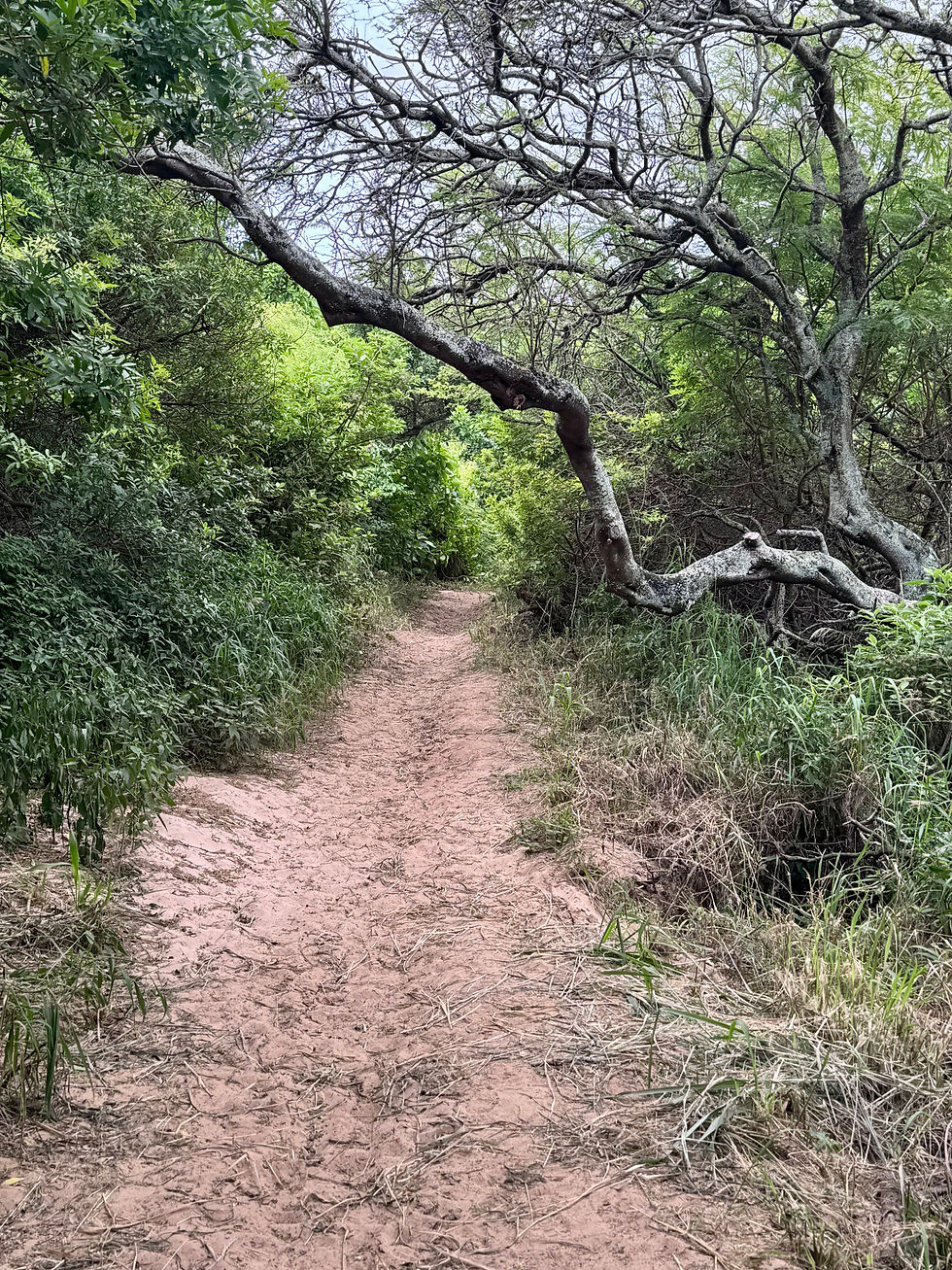
As mentioned, there are many smaller trails as you walk through the tall grass—just follow the coastline.
This sandy stretch leads to the Makawehi and Pa’a Dunes, ancient sand dunes that have solidified into limestone over centuries (also known as "lithified sand dunes"). Within these cliffs are fossils of coral and algae. As you walk along this coastal section, keep an eye out for sea turtles gliding through the turquoise waters, just off the cliffs.
Beyond the limestone cliffs, the trail descends to a rocky beach before passing the Waiopili Heiau, a sacred Hawaiian site. As you continue, you'll notice the ground turning noticeably redder, with volcanic rocks scattered about. The Waiopili Heiau, an ancient Hawaiian shrine used for religious ceremonies, dates back hundreds of years. As with the rest of the trail, please treat this area with respect—take only photos, leave only footprints, and pack in, pack out. Stay on the trail and refrain from removing any artifacts from the heiau.

Next, the trail takes you through the Poipu Bay Golf Course, once home to a PGA Grand Slam event. It runs right along the edge of the course, next to the coastline. Walking along this pristine, manicured golf course can feel a bit strange, as you might wonder if a stray golf ball will come flying your way!


You’ll pass through a small area with lush green shrubs, and once you emerge on the other side, you'll be greeted by a stunning view of Maha’ulepu Beach. As you descend toward the beach, you'll pass by CJM Stables, which marks the official endpoint of the Maha’ulepu Heritage Trail, Punahoa Point. From here, you have two options: you can retrace your steps back to the trailhead, or if you're up for more exploring, continue on.

Near the Maha’ulepu Beach endpoint, you can continue on to the Makauwahi Cave Trail. This trail leads to the largest limestone cave in the entire state and one of the richest fossil sites on the island, boasting fossils of more than 40 species of ancient birds alone! Additionally, the area around the cave, the Makauwahi Cave Reserve, serves as an ecological reserve for over 100 native plant species, including several endangered varieties, and provides a habitat for native animals.
From Punahoa Point, continue along the Heritage Trail past CJM Stables. You’ll see a sign directing you to the Makauwahi Cave Trail—do not take this turn. Instead, keep following the coast toward the tree tunnel. Once you pass through the tree tunnel, turn left to walk uphill, and follow the signs for the Foot Trail. This trail will lead you to a viewpoint overlooking Makauwahi Cave.

If you'd like to explore the cave itself, head downhill along the Foot Trail. As you walk through the trees, you'll follow the Waiopili Stream. You'll come across a wooden bridge on your right—do not cross it. Instead, continue along the limestone wall until you reach the cave opening on your left.
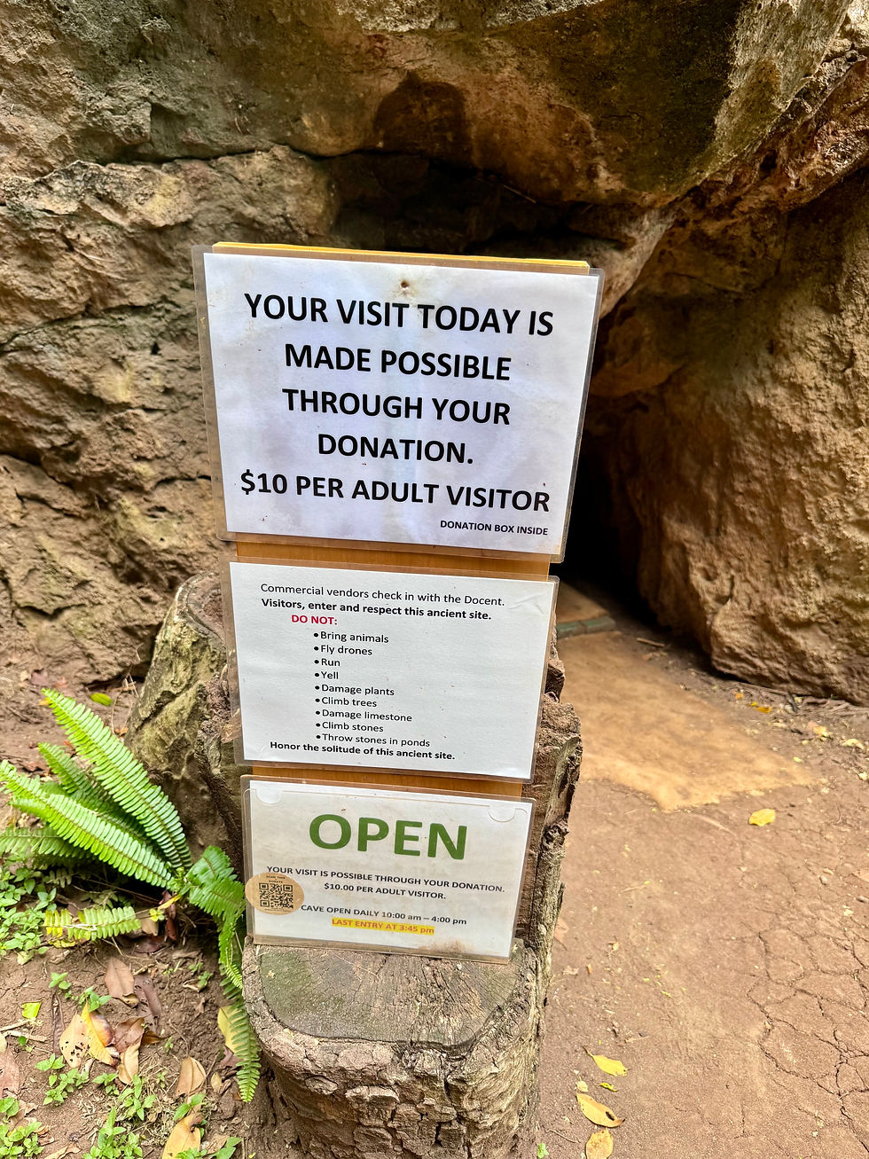
The Makauwahi Cave Reserve is Hawaii’s largest limestone cave and a significant archaeological site. The cave acts as a living museum, offering insights into the native animals and plants of the Polynesian islands. To enter, you'll need to crawl through a small opening, which may feel a bit intimidating. Once inside, you'll find yourself in a spacious cave area with a large opening that leads to a beautiful clearing surrounded by trees and a protected ecosystem. Be prepared to get a little dirty. A guide is available inside the cave to provide information and answer any questions. The Makauwahi Cave Reserve is open from 10 a.m. to 4 p.m. It's free to visit, though a $10 donation is recommended.


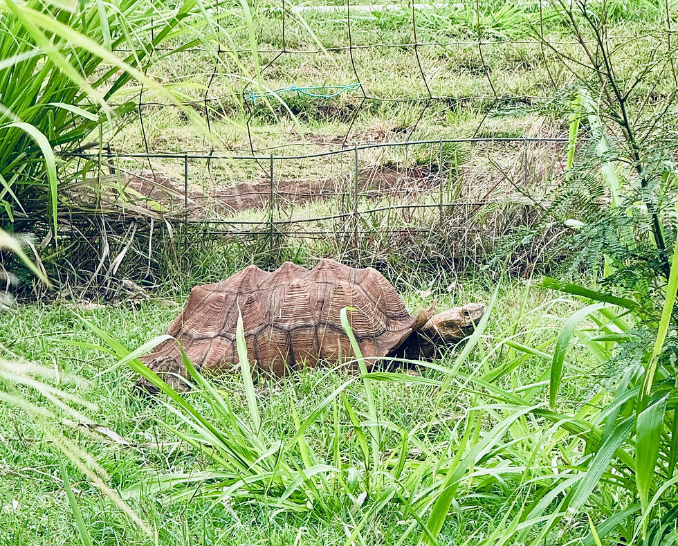
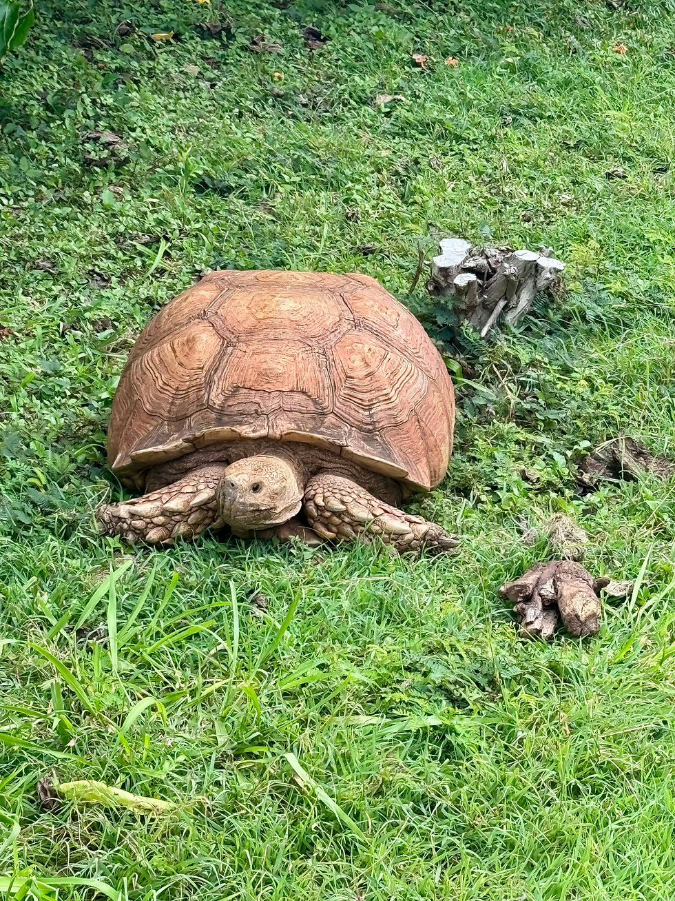
Just next to the Makauwahi Cave Reserve is Lida’s Field of Dreams, a tortoise refuge featuring native plants and tortoises. To visit, walk back to the bridge, cross it, and continue straight ahead. On your left, you’ll notice a fence. The easiest way to see the tortoises is by using the pair of staircases over the fence.

There, you'll find individual pens where nearly two dozen tortoises roam freely. Visiting Lida’s Field of Dreams is free, though donations are appreciated. There are also bathrooms available for use.
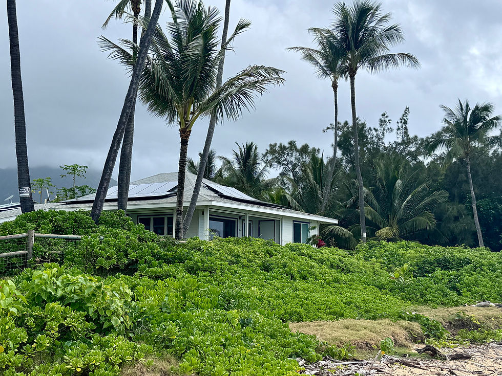
You can end your hike here or continue for about 5 more minutes to Gillin’s Beach (also known as Maha’ulepu Beach). Head toward the water, where you’ll find a long stretch of beach with cliffs to the north and Gillin's Beach House to the south. A single house sits in front of the beach, so be sure to show respect.

The area is bordered by woods, offering plenty of shade. One of the perks of this beach is that you can walk along it to reach Kawailoa Beach, about a 10-15 minute stroll away. This secluded spot features a cove with rocky oceanfront and a unique rock with a hole in it—almost like a sea arch, but not quite.
The entire hike from Shipwreck Beach to Gillin’s Beach is about six miles round trip—three miles out to Gillin’s Beach and three miles back. If you’d prefer a shorter walk but still want to visit the Makauwahi Cave Reserve, Lida’s Field of Dreams, and Gillin’s Beach, you can park at CJM Country Stables (listed as Maha'ulepu Beach Parking on Google Maps). From there, it’s roughly a one-mile walk to Gillin’s Beach and another mile back.

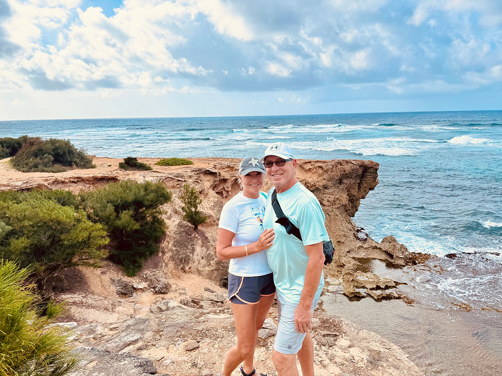
We thoroughly enjoyed this hike and highly recommend it. The coastal views were absolutely stunning! The highlight of our adventure was visiting the Makauwahi Cave and the tortoise refuge. I suggest wearing hiking sandals, bringing plenty of water, and packing a light lunch to enjoy on one of the beaches. You might also want to bring a swimsuit so you can take a dip in one of the small beaches along the trail.


Comments